GEORGE STREET, GLASGOW
Grade A Listed Building
Malcolm Hughes Land Surveyors Ltd were recently involved in a highly detailed survey of a Grade A listed building in Glasgow
The former parish council offices on George Street were designed by Thomson and Sandilands Architects and built in 1900. The building was grade A listed in 1989 and was acquired by The Chris Stewart Group from Glasgow City Council in 2015 for re-development.
Ogilvie Construction Ltd were appointed as principal contractor for the construction of a mixed-use complex development, which includes a hotel and living accommodation.
During construction, the glazed brick rear façade had sustained considerable movement, which required remedial work once the movement had been stabilised. Malcolm Hughes Land Surveyors were appointed to carryout detailed surveys of the façade.
As a listed building, it was particularly important to record multiple accurate positions to ensure that any movement was understood in the x,y and z axes.
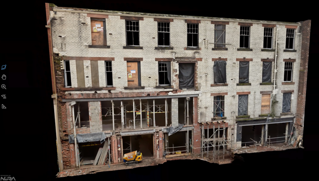
We worked with the architect to put together a bespoke survey deliverables proposal, which included a 1-millimetre spacing 3D point cloud, detailed 2D AutoCAD elevations, an ortho-image and a photo-realistic 3D textured mesh of the facade.
We undertook the survey using a combination of methodologies to achieve the best accuracy and coverage possible within the limited time window available.
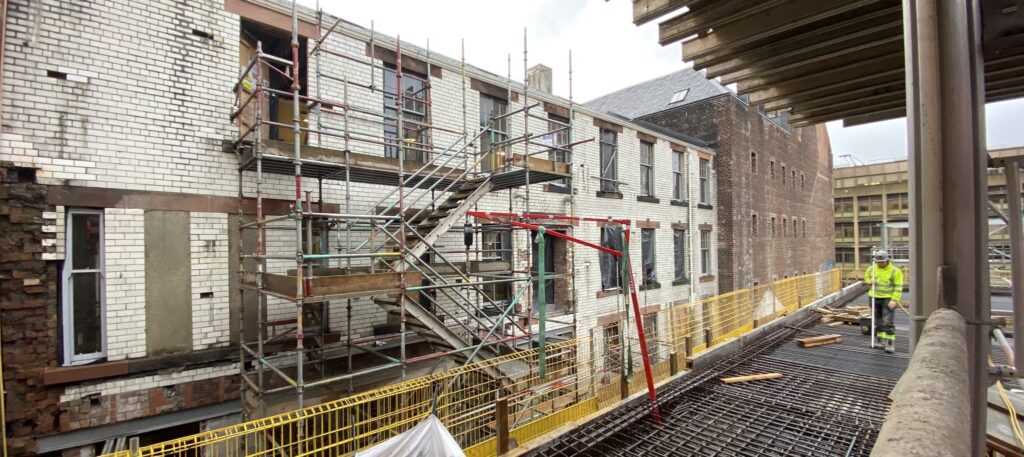
To accommodate the operational building site, we scheduled the data capture element of the works to be carried out at a weekend to avoid disruption to the site teams and ensure the highest accuracy of our data. We were fortunate that the site conditions allowed for us to position ourselves on an adjacent building at various levels to give the best coverage and maximum point cloud density. Overall we observed 40 laser scans on a 300sq.m. façade with all data tied to existing site coordinates with an accuracy of a few mm – the resultant point cloud was used as the basis for the geometry of the 3D mesh.
At the same time, we observed 650 images with a DSLR camera which were stitched together in photogrammetry software; the imagery was used to apply for texture and colour to the mesh.
The dense 3D point cloud was also utilised to draw 2D elevations to Historic Scotland Specification (RICS Accuracy Band B). The elevations were to be extremely detailed, and as such each brick was drawn individually on all four sides. In total, almost 8000 bricks were drawn!
Once all deliverables were complete, we uploaded our textured mesh to an online viewer “Nira”. This is a powerful application, which allows the end user to view rendered models online, on any device including smart phones without the need to download 3rd party software and deal with large file sizes. It can be used to view and interrogate the mesh in 3D, take measurements and share unique insights with the design team and other stakeholders.
